
{{product.productLabel}} {{product.model}}
{{#if product.featureValues}}{{product.productPrice.formattedPrice}} {{#if product.productPrice.priceType === "PRICE_RANGE" }} - {{product.productPrice.formattedPriceMax}} {{/if}}
{{#each product.specData:i}}
{{name}}: {{value}}
{{#i!=(product.specData.length-1)}}
{{/end}}
{{/each}}
{{{product.idpText}}}
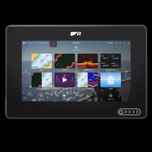
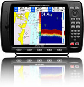
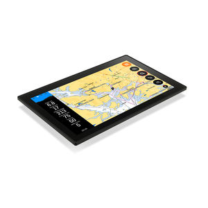
... 12‑inch sizes. Available as chartplotter‑only or with built‑in RealVision™ sonar. The Marine Chartplotter You Trust. Now Even Better Our most popular marine chartplotters — now faster, more connected and built for ...
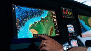
... DESIGNED TO BE THE WORLD’S MOST INTUITIVE CHARTPLOTTER Built on our latest NEON™ OS, the NSO 4 chartplotter combines unmatched ease of use with exceptional performance and refined design. Our biggest displays are the perfect match for the water’s most ...
Simrad Yachting
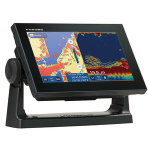
... At any time, you can watch the sea conditions or use the GP-1871F/1971F's functions remotely from another location on the boat. *Regarding the connection and the utilization of the application, please refer to the Operating Manual. *You ...
Furuno
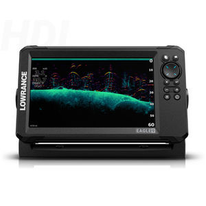
... below the boat with SplitShot™ HD, featuring the fish-finding capability of wide-angle high CHIRP sonar and the high-resolution images of fish-holding structure from DownScan Imaging™ Perfect for anglers who want the best views below ...
Lowrance

... /strong>
Small-footprint unit designed to present extensive
boat data on a compact screen. The laser touch-button enables navigation through up to 5 customizable screens in typical
deck conditions.
Each screen ...
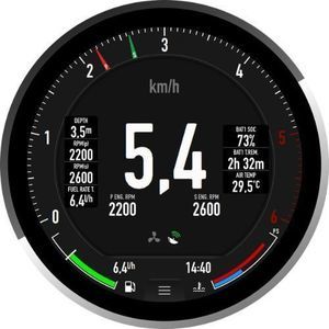
VERATRON
... Overview
The VMH 35-D GPS is a compact
multifunction display built as a standalone
instrument for monitoring diesel engines and vessel parameters. It integrates a high-performance GPS receiver for speed, position ...
VERATRON
... Overview
Compact
marine
multifunction display for monitoring engine and
boat data with SAE J1939 connectivity.
Product description
The VMH Flex presents extensive
boat ...
VERATRON
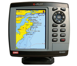
... The GME G-Plot offers a simple to use highly featured GPS chartplotter. Incorporating a 16 channel internal GPS antenna for fast GPS updates, perspective view, animated navigation markers and plotter mode are some of the many functions of this unit. Multiple ...
GME electrophones

... Brite 4.3- inch Color LCD Display 4.3- inch Color LCD Display provides larger letters and a variety of colors for high visibility even under bright sunlight. More accurate position 72 channel parallel gives more accurate position on “Position”, ...
Koden electronics
... map data. Of course, the plotter also communicates locally with your boat via the NMEA 2000® network. This gives you access to all the data measured by your onboard instruments. A radar option is available as well ...
10" Color Sunlight Viewable WAAS GPS / C-Map MAX compatible Chart Plotter
Standard horizon
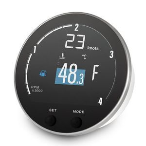
... Product Overview
The E360 is a premium 4-inch round touchscreen
marine gauge and chartplotter designed to upgrade your
boat’s cockpit with a blend of luxury and retro elegance. Featuring an intuitive interface, ...
LXNAV d.o.o.
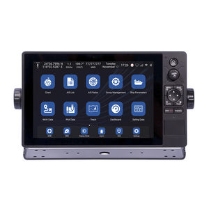
... approval. · Support Ethernet, WIFI and 4G network communication. · Support C-MAP (MAX) and S-63 chart format. XN60 series multi-function intelligent display integrates functional modules such as GNSS, chart plotter, Class B AIS, ...
Xinuo Information Technology (Xiamen) Co.,Ltd
... Control of the strength in the rig and the sheets Management of critical situations (MOB, collision, shallows, wind gusts) Multi-alarm management function Flooding detection Data logging And much more Features 6 relay outputs ...
OCEAN DATA SYSTEM
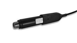
... decimal resolution and sends the relevant pgn to the NMEA network. You may also connect your WindyPlug with all NMEA2000 marine display equipment compatible, of new and old generation! For one WindyPlug unit, there are two virtual ...
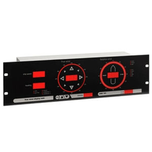
The OMC-131 True wind display is specially designed for easy read out of "true" and "relative" wind information on board sea going vessels. The unit is suitable for panel mounting as well as mounting into a standard 19" rack. Any inclination is allowed ...
Skyview systems
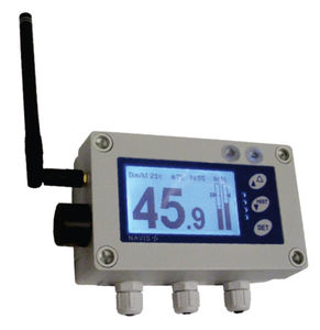
... FOR CONSTRUCTION SITES AND INDUSTRY long range wireless sensor (500 m/1300 m) integrated sound alarm and warning lights extremely easy mounting due to wireless sensor and magnetic mounting optional wireless repeater displays ...
NAVIS elektronika
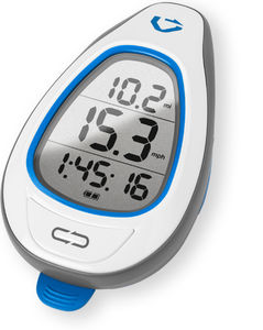
... GPS for SUP The Makai is the first GPS that’s specifically designed for SUP. It measures the Doppler shift in GPS signals to calculate your speed every half-second. Optimize your stroke without interrupting it The Makai's big numbers let you see ...
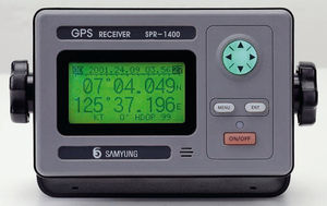
... 1575.42 MHZ (C/A code) • Display Resolution : 128×64 dot LCD(3inch) • Receiving Type : Digital 12 Channels multi tracking type • Receiving Sensitivity : below -130dBm • Resolution : 1/1000 Lat. and Longitude • ...
Navis USA LLC
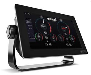
... The powerful new multifunction navigation systems from Nanni. With available builtin RealVision 3D™ sonar, the all new LightHouse 3 operating system, and blazing fast quad core performance, SI.7 to SI.12 will transform your experience ...
... completely new user experience.To facilitate a new way of boating, we have completely rethought the way you interact with the boat. Inspired by the automotive and handheld smartdevice industries, we have taken all key functions and integrated ...
the best suppliers