
{{product.productLabel}} {{product.model}}
{{#if product.featureValues}}{{product.productPrice.formattedPrice}} {{#if product.productPrice.priceType === "PRICE_RANGE" }} - {{product.productPrice.formattedPriceMax}} {{/if}}
{{#each product.specData:i}}
{{name}}: {{value}}
{{#i!=(product.specData.length-1)}}
{{/end}}
{{/each}}
{{{product.idpText}}}
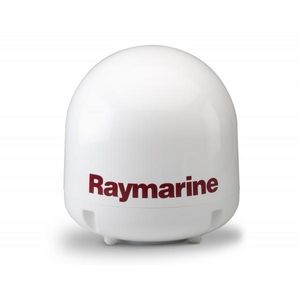
Frequency range: 10.7 GHz - 12.75 GHz
Operating temperature: -25 °C - 55 °C
Elevation: 10 ° - 80 °
... from the Ku-band. The HD module is actually built-in to the Antenna Control Unit of the 37STV for seamless integration and easy installation. Built-in GPS The 37STV includes a built-in GPS for easier ...
Raymarine

Elevation: 10 ° - 80 °
Diameter: 37 cm
Length: 43 cm
... performance compared to antenna systems of a similar size. With its stylish dome, the i3 is ideal for boats over 8m (25ft). The i3’s high signal gain makes it the best performing 37cm (15in) antenna system available today ...
Intellian Technologies

Operating temperature: -25 °C - 60 °C
Diameter: 91 mm
Weight: 100 g
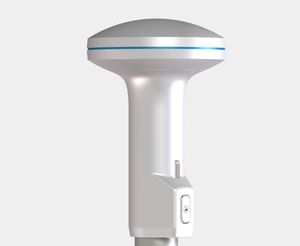
... The B&G ZG100 GPS antenna provides precise and dependable position data making it the perfect partner for B&G chartplotters and instrument systems. The highly accurate 10 Hz GPS gives precise and smooth ...

Frequency range: 10.7 GHz - 12.75 GHz
Gain: 33 dB
Operating temperature: -20 °C - 55 °C
... manage the “NEO” satellite TV antennas in one click via Bluetooth® with your own smartphone/tablet and: update the satellites list update the antenna select and change satellites send the operating parameters of ...
... The G2183 is a highly accurate GPS antenna—WAAS/EGNOS enabled. It is one of the first true 10 Hz GPS antennas made available. Scoring high in sensitivity, it delivers quick signal acquisition, ...

... The patented Airmar GH2183 combines GPS positioning and highly accurate heading information in one compact antenna. The GH2183 eliminates the need to install a GPS antenna above deck ...
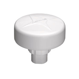
Frequency range: 1,525 MHz - 1,560 MHz
Electrical power: 3.2, 3.6 W
Operating temperature: -40 °C - 70 °C
... accurate heading and positioning performance available with the Vector™ V200 GNSS compass. The multi-GNSS Vector V200 supports GPS, GLONASS, BeiDou, Galileo, and QZSS. The Vector V200 offers an incredible combination of simple installation, ...
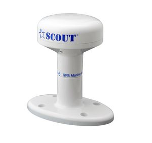
Hemisphere GPS
... Maretron's GPS200 is a state-of-the-art 99 channel GPS/GLONASS antenna and receiver capable of providing ten position fixes per second, accurate boat speed ten times per second, and precision time once ...
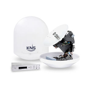
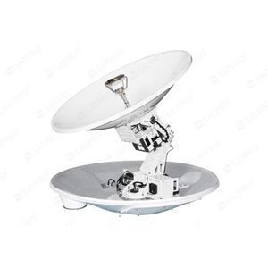
... the state of the art KNS 3 axis servo stabilization system and the built-in GPS, The S-Series outperforms all other TVRO systems in the market today. Larger S-Series antennas providing stronger signal acquisitions are ...
KNS

... The V560 Marine Antenna is a high-precision GNSS antenna that delivers reliable and precise positioning. The multi-frequency and multi-constellation antenna allows reception of all available GNSS signals. ...
Diameter: 46 mm
Weight: 100 g
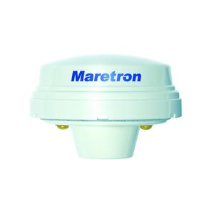
... Product Overview
The GPSN2K is a
GPS
antenna designed for marine applications, providing precise and reliable position data. With its robust construction and advanced features, it ensures accurate navigation ...
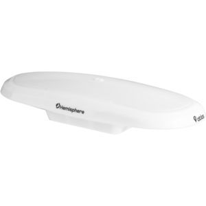
Frequency range: 156 MHz - 162.5 MHz
Gain: 2.15, 3 dB
Operating temperature: -40 °C - 60 °C
... VHF/ GPS-04 is a VHF antenna with an integrated helix GPS/GLONASS antenna for frequencies 1575.42 MHz and 1602 MHz. This antenna is manufactured from premium quality materials ...
AC ANTENNAS A/S
Frequency range: 1,572 MHz - 1,610 MHz
Gain: 23, 24 dB
Electrical power: 0.1 W
... NAV-6 to a GPS or GLONASS receiver to act as an external antenna and improve the reception signal when the GPS unit doesn’t have a good view of the sky and the internal antenna doesn’t ...

Frequency range: 617 MHz - 4,200 MHz
Gain: 6.2, 7, 21 dB
Electrical power: 10 W
... 2.4 GHz & 5 GHz) and GPS/GLONASS. The 2x Cellular MIMO antennas (for 2G/3G/4G) cover the 617 to 4200 MHz band, this includes the most popular international LTE/5G bands. The antenna provides two separate ...
Poynting Antennas
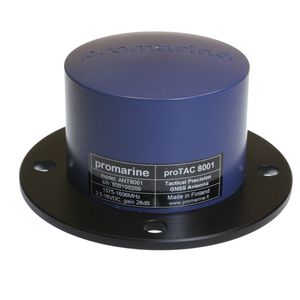
... 8002 is designed to easily replace existing marine GPS antennas in high interference environments. It is DC-floating design enables the use with any GPS receiver and TNC connector fits to most existing ...
Promarine Ltd

... GR-600 is a cute, compact, easy to bring, ultra-high performance, low power GPS USB dongle. The built-in u-blox 6 chip and our experienced design provide fast acquisitions and excellent tracking performance. It is a perfect companion ...
Navisys Technology Corp.

... . GPS active antenna . Center Frequency: 1575.42 MHz +/-1.023 MHz . Polarization: R.H.C.P. (right hand circular polarization) . 10 meter RG-58CU with BNC connector (standard), TNC and others (optional) . Axial Ratio: ...
Wenden Radio Co., Ltd.
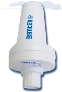
... VHF / AIS antenna with GPS Integrated antenna - Mounting 1 "gass NAVY - N connector - including Splitter box MECHANICAL FEATURES Lenght 20 cm Weight 400 gr Bottom diameter 90 mm Working ...
Banten antenne radio
Frequency range: 1,575.42 MHz - 1,610 MHz
Gain: 23, 24 dB
Operating temperature: -40 °C - 85 °C
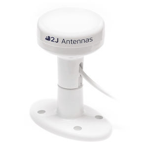
... High Precision and Compact Marine Satellite Antenna Ideal For Accurate Positioning This external active GNSS antenna offers the best overall performance and it is ideal for high-performance marine applications that ...
2J Antennas s.r.o.

... Description AG100 GPS Antenna – Overview: The AG100 is a GPS antenna for use with the CSB200 Class B Transceiver and all Comar AIS receivers with a GPS input. A high ...
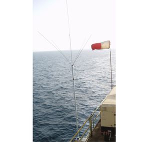
... The STA 150 NDB is a self-supporting mast antenna for use on vessels, offshore platforms, airports, heliports, etc. The mast does not need guys or stands. It replaces costy and spacious wire arrangements and can be installed on room limited ...
Frequency range: 10.7 GHz - 14.5 GHz
Gain: 41.3 dB - 42.5 dB
Electrical power: 250 W
... identification 4)Attitude and GPS data realtime output 5)High gain horn array panel antenna 6)Seamless auto satellite beam switching across the sea area 7) Antenna remote monitoring technology 8)Hightransparent ...
Xi’an Satpro Measurement And Control Technology
... The 72-channel GNSS receiver benefits from advanced technologies such as: • Receive and track multiple satellite systems ( GPS, QZSS, GLONASS, and BeiDou) • Support for Satellite-Based Augmentation System (SBAS): EGNOS, WAAS, and MSAS The ...
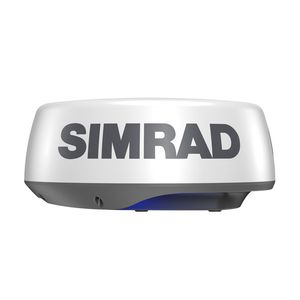
... coverage—up to 36 nautical miles—from a compact 20-inch dome antenna. See Near and Far with One Compact Dome Perfect for a wide range of coastal bay boats, HALO20+ comes in a compact dome antenna and delivers high-quality ...

... Powertec Satellite TV antenna brings you an onboard High Definition Entertainment system. Our antenna system automatically track and receive satellite TV signals. Key Features High Definition (HD) compatible. Conical ...
the best suppliers