
{{product.productLabel}} {{product.model}}
{{#if product.featureValues}}{{product.productPrice.formattedPrice}} {{#if product.productPrice.priceType === "PRICE_RANGE" }} - {{product.productPrice.formattedPriceMax}} {{/if}}
{{#each product.specData:i}}
{{name}}: {{value}}
{{#i!=(product.specData.length-1)}}
{{/end}}
{{/each}}
{{{product.idpText}}}
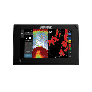
... to four split-screen windows.
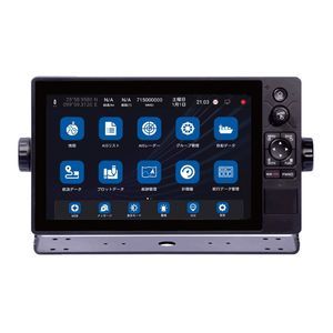
Koden electronics
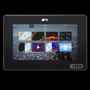
... operating system is a single, simple-to-use interface for complete situational awareness. Make Axiom 2 your all-in-one multifunction display or connect additional Axiom 2 displays at your helm or a remote station. See More Below the ...
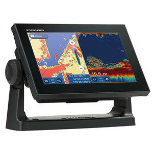
... GPS/WAAS CHART PLOTTER with built-in CHIRP FISH FINDER 9" GPS Chart Plotter/Fish Finder with Tablet Control/Mirroring function Available. Wireless Connection to Smartphone and tablet ...
Furuno
... you input waypoints and routes and view chart details with ease. Simple to add Waypoints and Routes Let Vulcan guide you safely to your destination: place waypoints and routes with a single tap on the chart and let ...
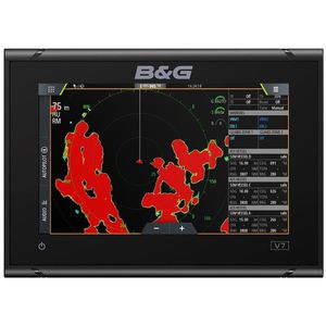
B & G
... all NSX features, including smart drag-and-drop screen customization, fully editable instruments bar and enhanced day and night modes. Get crystal clear views of chart detail, structure and bottom contours with the vibrant ...
Simrad Yachting
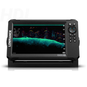
... With razor sharp vision, the Eagle was born to fish. Get autotuning sonar, detailed C-MAP charts, and an always-visible IPS screen. That’s everything you need to dominate out on the water with total ease and no distractions. Enhanced ...
Lowrance
... . Incorporating a 16 channel internal GPS antenna for fast GPS updates, perspective view, animated navigation markers and plotter mode are some of the many functions of this unit. Multiple screen options are available and 6 can be 'saved ...
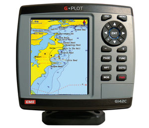
GME electrophones
... Platinum+ charts, the world leaders in this field. Navionics charts offer an excellent selection of layers and features, making them perfect for both the user who wants to see everything and the user who just wants the ...
... 10" Color Sunlight Viewable WAAS GPS / C-Map MAX compatible Chart Plotter ...
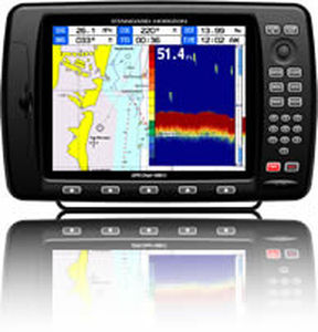
Standard horizon
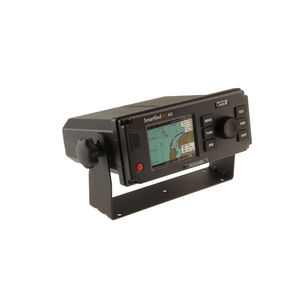
... equipped vessels on a chart overview display - without the need to connect to an external plotter. Designed to operate as a stand alone unit, the SMARTFIND M5 can also be integrated with ECDIS (Electronic Chart ...
... become critical.
Integrated Chartplotter
Comes with an integrated OpenSeaMap nautical
chart (free of charge) and supports Navionics
charts via SD card. Features include no-wake zones, anchor watch, course ...
LXNAV d.o.o.
... WIFI and 4G network communication. · Support C-MAP (MAX) and S-63 chart format. XN60 series multi-function intelligent display integrates functional modules such as GNSS, chart plotter, ...
Xinuo Information Technology (Xiamen) Co.,Ltd
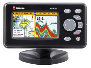
... 100 Routes, with up to 100 points each • Tracks : By time or distance, 10 track of 15,000 points • Chart datums : 216 Chart datums (see next page) • Chart scale : 0.2 ~ 500 nm • Interface : NMEA 0183 • ...
Navis USA LLC
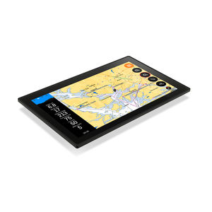
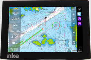
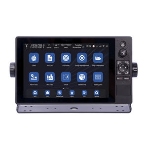
Not just a chartplotter. A completely new user experience.To facilitate a new way of boating, we have completely rethought the way you interact with the boat. Inspired by the automotive and handheld smartdevice industries, we have taken all key functions ...
the best suppliers