
- Products
- Catalogs
- News & Trends
- Exhibitions
Hydrographic software TD50for researchvisualizationfor ships
Add to favorites
Compare this product
Characteristics
- Function
- visualization, hydrographic, for research
- Applications
- for ships
- Type
- real-time, 3D
Description
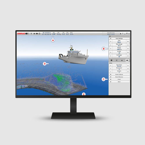
The TD50 3D Visualization software is a visualization tool that serves as a high-effective decision support instrument for research purposes and scientific surveying. It reads echo data in real time from the EK80, ME70 and MS70 systems. It can also read ADCP data from the EK80.
Improve survey efficiency
The TD50 3D Visualization software improves the overall efficiency of scientific surveying, being especially relevant to projects using adaptive sampling. The TD50 presentation acts as a "long range camera" below the surface. It enables you to see specific attributes as the vessel passes over them.
Map import
You can personalise the TD50 3D presentation by importing bottom topography and habitats to match your geolocation.
Key features
Highly effective decision support tool
Live-streaming in real time
Highly accurate visualization of the entire water column
3D view of topography and the related bottom habitats
Available for live streaming data from EK80, ME70 and MS70, including ADCP data
Current software version
We recommend that you always keep your system updated with the latest software version.
All applicable information related to this software release can be found in the Software release note.
Catalogs
No catalogs are available for this product.
See all of Simrad‘s catalogsRelated Searches
- Boat sensor
- Temperature sensor
- Echo sounder
- Depth transducer
- Ships sensor
- Acoustic sensor
- Fishfinder sensor
- Ship software
- Boat echo sounder
- Digital echo sounder
- Multibeam echo sounder
- Monitoring system
- Side scan echo sounder
- Ship monitoring system
- Wireless sensor
- Ship echo sounder
- High-resolution echo sounder
- Pitch sensor
- Roll sensor
- Multifunction monitoring system
*Prices are pre-tax. They exclude delivery charges and customs duties and do not include additional charges for installation or activation options. Prices are indicative only and may vary by country, with changes to the cost of raw materials and exchange rates.

