
{{product.productLabel}} {{product.model}}
{{#if product.featureValues}}{{product.productPrice.formattedPrice}} {{#if product.productPrice.priceType === "PRICE_RANGE" }} - {{product.productPrice.formattedPriceMax}} {{/if}}
{{#each product.specData:i}}
{{name}}: {{value}}
{{#i!=(product.specData.length-1)}}
{{/end}}
{{/each}}
{{{product.idpText}}}
... the sensor data and collectively feed it to ECDIS and Chart Radar in the system. Since the sensor adapters can be extended to cover all the sensors within the system, individual cablings in the sensor-to- ECDIS/Radar interface ...
Furuno
... Intuitive and cost-effective ECDIS The ECDIS NX Compact is a powerful Electronic Chart Display and Information System ( ECDIS), consisting of a pre-configured system of the ECDIS NX application ...
Anschuetz
... Information System ECDIS EC-8100, EC-8600 with Track Control System Electronic Chart Display and Information System ECDIS EC-8600 EC-8600 (26 inch) Electronic Chart Display and Information System ECDIS ...
... 5818 Electronic Chart Display and Information System ( ECDIS) consist of host and display, there are two size of display, 19 inch and 24 inch, users can select according to their actual need. The ECDIS includes functions ...
... Displays With Projective Capacitive Multi-Touch Screen Color Calibrated For Ecdis Compliance (Optional) Capacitive Touch Keys For Quick Function Access and Display Control (Support Ecdis Day, Dusk, and Night Mode Switching) Meets ...
... Basic configuration including monitor, keyboard, computer unit with basic interfaces, installation kit, user manual. The ECDIS models are type approved by DNV, having been tested according to the latest specifications of IMO, IHO and ...
... concentrate and distribute NMEA data signals. Full control of appearance and user interface. Dynamic databases: ● ECDIS navigation functions; ● Route planning; ● Voyage Data Recorder; ● More accurate than ...
... Flexibility in modes: Radar Overlay, ECDIS, Conning Info Display and Central Alarm Management From standalone ECDIS to a multi node networked system (optional) Fully compliant The VisionMaster FT ECDIS ...
Sperry Marine
... Navmaster ECDIS is a well-established Electronic Chart Display and Information System, incorporating the input of many navigators. Designed to deliver clear functionality and ease of use in a familiar MS Windows environment, Navmaster ...
... member of a family of onboard navigational systems Fully complies the IMO requirements and IEC standard (IEC 61174) for ECDIS Electronic Charts and Databases used: Official S-57 Ed. 3.1. (and 3.0) Electronic Navigational Charts ...
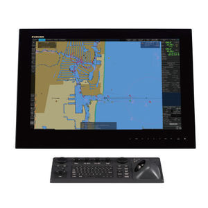
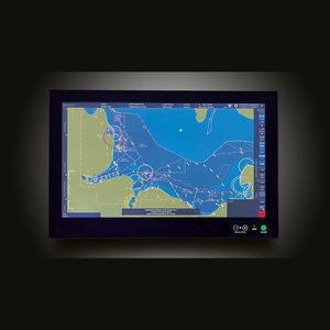
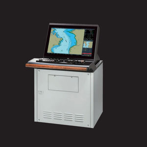
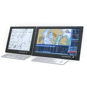
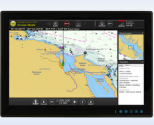
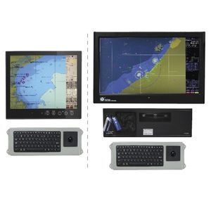
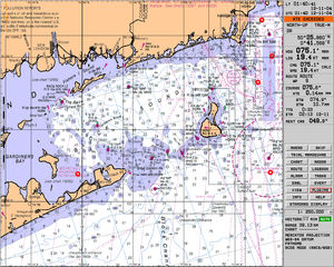
A ship ECDIS (Electronic Chart Display and Information System) is a navigational aid combining a display and software for both vector and raster (scanned) digital charts, as well as numerous complementary data. NauticExpo offers units for professional use, such as on cargo ships.
ApplicationsThese systems are essential aboard modern commercial vessels, especially ships sailing the high seas or in dangerous areas. They are mandatory on certain ships, as defined by international conventions and classification organizations.
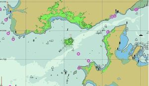
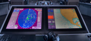
TechnologiesThe ECDIS can display digital navigational data like C-Map or CM93 cartography, and are immensely helpful in decision-making. Certain versions include weather modules and display radar imagery, water depth, speed, ice conditions and other data. An ECDIS can be connected to alarm systems and management software for cargo balance, engine, fuel and stores management, or other control functions.
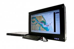
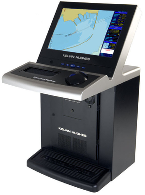
It takes the form of a console whose central element is a screen, often very large (24 inches minimum). Some models have two or three screens for simultaneous display of different data. The system is controlled by a combination of push-buttons, a keyboard, joystick, switches and a mouse, usually in trackball form.
the best suppliers