
{{product.productLabel}} {{product.model}}
{{#if product.featureValues}}{{product.productPrice.formattedPrice}} {{#if product.productPrice.priceType === "PRICE_RANGE" }} - {{product.productPrice.formattedPriceMax}} {{/if}}
{{#each product.specData:i}}
{{name}}: {{value}}
{{#i!=(product.specData.length-1)}}
{{/end}}
{{/each}}
{{{product.idpText}}}
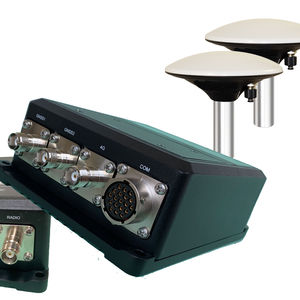
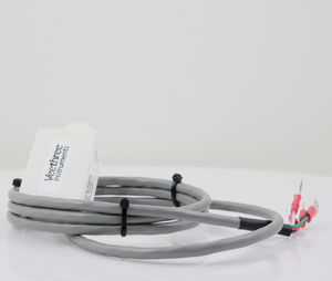
1 cm Position, 0.01° Heading Capable Professional RTK receiver suitable for USVs, dynamic positioning, hydrographic and scientific applications Dual marine grade antenna for precise heading calculations FCC and CE ...
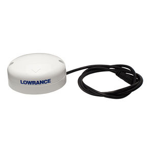
The Lowrance Point-1 is the ideal position and heading device for the Lowrance AutoPilot. The Point-1 provides extremely accurate and rapid boat position and speed updates. In addition – unlike other position-only antennas – the Point-1 ...
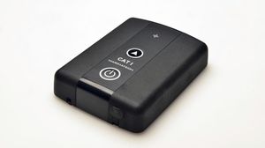
The CAT I is a stand-alone high accuracy GPS receiver with the capability of GPS/GLONASS and available SBAS systems such as EGNOS, WAAS, MSAS and GAGAN CAT I is an add-on option ...
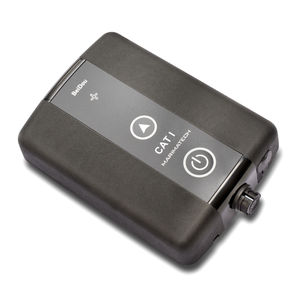
The SafePilot CAT I Beidou is a stand-alone high accuracy GPS receiver with the capability of GPS/Beidou and available SBAS systems such as EGNOS, WAAS, MSAS and GAGAN. CAT I Beidou ...

The ICE AS GPS HS is a precision GPS receiver with heading sensor designed specifically for ICE fishing. An internal compass also provides constant heading displayed on your Humminbird ...
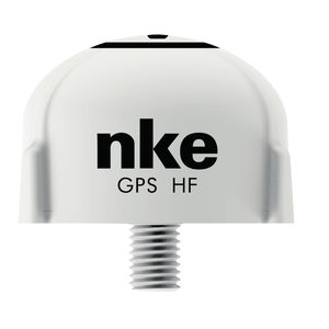
... A very reactive speed over ground. This HF GPS is a great alternative to the conventional speed sensor. It allows a very accurate measure of the starting line. Once we have supplied high frequency GPS ...
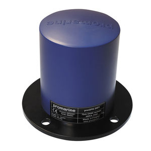
... black box" GNSS receiver with exceptional performance. GNSS receiver is based on 72-channels, high sensitivity GNSS receiver with anti-jamming detection and removal. proGPS 2000 is ...
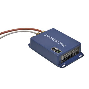
... concurrent GNSS receiver with integrated proTAC-series active GNSS antenna. The receiver is based on 72-channels with advanced jamming and spoofing detection and removal. proGPS 2001 is a high performance, ...

The Vector™ VS1000 is Hemisphere GNSS’ premiere multi-GNSS, multi-frequency receiver designed specifically for the professional marine market. Providing precise heading, Athena RTK positioning, and full Atlas Global Correction ...
The Nobeltec USB GPS 9P Portable is an easy-to-use, affordable and feature filled GPS solution. The GPS module receiver will track up to 20 satellites at a time while ...
The Veethree GPS Receiver is the most accurate solution for converting an existing electrical speedometer into a GPS speedometer. Standard GPS with 1-second (1Hz) ...
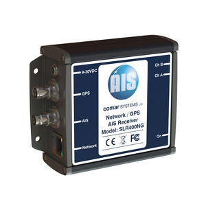
The SLR400NG is an AIS receiver unit with built in GPS Receiver and Ethernet interface, designed specifically for coastal monitoring of AIS equipped vessels. Connected to an Ethernet ...
Comar Systems
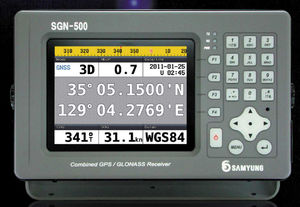
... 84, WGS-72, EARTH-90, PULKOVO1942, PULKOVO1995) • Location Information Renewal Cycle : every 1 second • Precision location : GPS/GLONASS: within ±30m Differential: within ±10m • Data Communication : NMEA0183: 4800, 9600, ...
Navis USA LLC
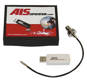
... channel AIS Receiver + GPS/GLONASS receiver USB connection RF connector MMCX Pigtail MMCX – BNC included Frequency AIS1 161,975MHz Frequency AIS2 162,025MHz concurrent receiving ...
Please specify:
Help us improve:
remaining