
{{product.productLabel}} {{product.model}}
{{#if product.featureValues}}{{product.productPrice.formattedPrice}} {{#if product.productPrice.priceType === "PRICE_RANGE" }} - {{product.productPrice.formattedPriceMax}} {{/if}}
{{#each product.specData:i}}
{{name}}: {{value}}
{{#i!=(product.specData.length-1)}}
{{/end}}
{{/each}}
{{{product.idpText}}}
... the sensor data and collectively feed it to ECDIS and Chart Radar in the system. Since the sensor adapters can be extended to cover all the sensors within the system, individual cablings in the sensor-to- ECDIS/Radar interface ...
Furuno
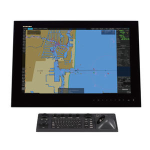
... Intuitive and cost-effective ECDIS The ECDIS NX Compact is a powerful Electronic Chart Display and Information System ( ECDIS), consisting of a pre-configured system of the ECDIS NX application ...
Anschuetz
... Information System ECDIS EC-8100, EC-8600 with Track Control System Electronic Chart Display and Information System ECDIS EC-8600 EC-8600 (26 inch) Electronic Chart Display and Information System ECDIS ...
... 5818 Electronic Chart Display and Information System ( ECDIS) consist of host and display, there are two size of display, 19 inch and 24 inch, users can select according to their actual need. The ECDIS includes functions ...
... Displays With Projective Capacitive Multi-Touch Screen Color Calibrated For Ecdis Compliance (Optional) Capacitive Touch Keys For Quick Function Access and Display Control (Support Ecdis Day, Dusk, and Night Mode Switching) Meets ...
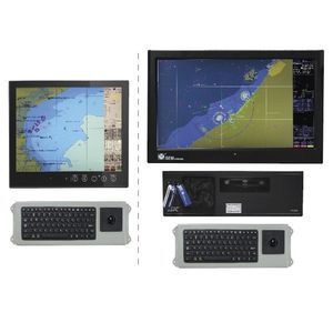
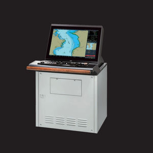
... Basic configuration including monitor, keyboard, computer unit with basic interfaces, installation kit, user manual. The ECDIS models are type approved by DNV, having been tested according to the latest specifications of IMO, IHO and ...
... concentrate and distribute NMEA data signals. Full control of appearance and user interface. Dynamic databases: ● ECDIS navigation functions; ● Route planning; ● Voyage Data Recorder; ● More accurate than ...
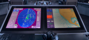
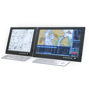
... Flexibility in modes: Radar Overlay, ECDIS, Conning Info Display and Central Alarm Management From standalone ECDIS to a multi node networked system (optional) Fully compliant The VisionMaster FT ECDIS ...
Sperry Marine
... Navmaster ECDIS is a well-established Electronic Chart Display and Information System, incorporating the input of many navigators. Designed to deliver clear functionality and ease of use in a familiar MS Windows environment, Navmaster ...
... member of a family of onboard navigational systems Fully complies the IMO requirements and IEC standard (IEC 61174) for ECDIS Electronic Charts and Databases used: Official S-57 Ed. 3.1. (and 3.0) Electronic Navigational Charts ...
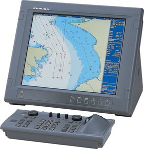
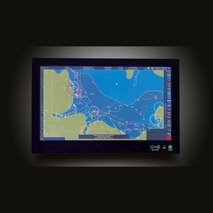
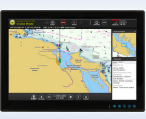
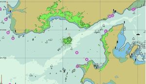
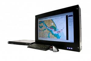
ECDIS, the Electronic Chart Display and Information System, is a computerized navigation information system.
ApplicationsThis system displays electronic nautical charts and can be connected to and integrated with other bridge instruments such as radar, AIS and GPS. ECDIS meets IMO chart carriage requirements.
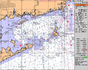
TechnologiesThere are two kinds of electronic charts, vector and raster. Vector charts are the electronic nautical charts (ENC) issued by governments authorized by the International Hydrographic Organization. Raster charts are basically scans of paper charts.
This computerized system uses charts issued by a national hydrographic office. It operates in ECDIS mode when ECN data is used, and in RCDS mode when ENC data is not available.
Requirements established by the IMO must be taken into account, especially when ECDIS replaces paper charts. Integration and compatibility with other equipment on the bridge also must be considered.
- Electronic updates
- Paperless
- Integration with other equipment
the best suppliers