- Equipment
- Marine Electronics
- Boat AIS
- Weatherdock AG
Boat AIS easyINFOBOX A053Class B receiverwith screen
Add to favorites
Compare this product
Characteristics
- Application domain
- for boat
- Type
- Class B receiver
- Other characteristics
- with screen
Description
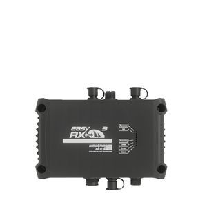
Product DetailsThe easyINFOBOX enables the position of AIS objects in the area to be displayed.The box is an extremely robust and waterproof PP/ABS box and includes an autonomous AIS system with AIS receiver and integrated chart plotter.Designed for the mobile usage of AIS dataPower supply possible via board netExterior plugs for GPS and VHF antennasProduct informationThe easyINFOBOX-Diving developed by Weatherdock is a shock-proof PP/ABS box with an integrated AIS receiver for diving groups. It is a robust, dust- and water-resistant housing for an AIS unit, receiving the signals from the activated easyDIVEPOS units of the group members which can be displayed by an integrated Chart Plotter. The easyINFOBOX is designed for the mobile usage of AIS data. By means of the DC plug, power supply of every board net can be used. The box has exterior plugs for GPS and VHF antennas.FunctionThe AIS unit inside the easyINFOBOX Diving receives via the connected VHF antenna transmitted signals within a distance of up to 12 nautical miles. The range depends on the receiving height of the VHF antenna. The received data are translated into NMEA0183 protocols and are transmitted to the Chart Plotter. By connecting the external GPS antenna, the AIS unit receives its own GPS position.ApplicationsHelicopter Rescue-Units of oil platforms or offshore wind parksDiving groupsLong-Term regattas with air supportCharter unitsIn addition to the regular reception of AIS data, the easyINFOBOX has also been developed to receive the position data of certain objects within a “closed user group” in the function of a mobile headquarters. Such an application can be implemented together with the portable Weatherdock position transmitters, vmsTRACK-PRO, easyAIRDROP, easyRESCUE-DIVE, easyPOS’N’HOOK or iridiumIONEER. These transmitter units send their position reports on a special, encrypted frequency so that only the headquarters are able to display this position data to their own “closed user group”. The use of the easyINFOBOX by diving groups is conceivable, where the INFOBOX remains as a base station on the diving ship. Another possible area of application is mobile surveillance of a specific area, e.g. at a regatta. The use of the easyINFOBOX in a rescue helicopter is also conceivable, since the built-in receiver receives the emergency signals from an activated “AIS Search and Rescue Transmitter” despite the predefined “closed user group” and these are displayed accordingly on the chart display device.HighlightsWaterproof and shock-proof PP/ABS boxIntegrated AIS receiver and chart plotterDesigned for mobile usePower supply via board net (DC plug)Exterior plugs for GPS and VHF antennasReceives signals up to 12 nautical miles (depending on antenna height)Receives and displays position data from Weatherdock portable transmitters for closed user groupsApplications: diving groups, helicopter rescue, regattas, charter units, mobile area surveillanceTechnical Specifications / FeaturesProduct type: Mobile AIS Receiving Station with Chart PlotterBox material: PP/ABS (shock-proof, waterproof, dust-resistant)Integrated AIS receiverIntegrated chart plotterPower supply: DC plug (board net)External connectors: GPS antenna, VHF antennaReception range: up to 12 nautical miles (depending on VHF antenna height)Data protocol: NMEA0183Special function: Reception of encrypted position data from Weatherdock transmitters for closed user groups
Catalogs
No catalogs are available for this product.
See all of Weatherdock AG‘s catalogsExhibitions
Meet this supplier at the following exhibition(s):


*Prices are pre-tax. They exclude delivery charges and customs duties and do not include additional charges for installation or activation options. Prices are indicative only and may vary by country, with changes to the cost of raw materials and exchange rates.


