- Maritime equipment
- Navigation, Communications, Electronics
- Navigation software
- Nonius Engineering LTD
- Products
- Catalogs
- News & Trends
- Exhibitions
Navigation, positioning and data acquisition software Viewervisualizationhydrographicfor ships


Add to favorites
Compare this product
Characteristics
- Function
- navigation, positioning and data acquisition, visualization, hydrographic
- Applications
- for ships
Description
Software for Bottom dredgersRequest
Quotation
Nonius™ Viewer
3D SURFACE DATA POSTRPOCESSING SOFTWARE FOR BOTTOM DREDGERS, HYDROGRAPHS AND GEODESISTS
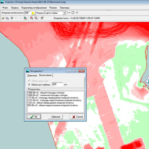
The Nonius™ Viewer is a post-processing software product that allows one to work with raw hydrographic data, as it can process survey data in various formats, including *.dwg and *.xyz in coordinate systems WGS-84 and UTM.
BESIDES SIMPLE VISUALIZATION OF HYDROGRAPHIC DATA THIS APPLICATION ALLOWS
To keep records of treated and designed amounts in the whole site or in a single part
To compare amounts using several layouts and maps
To calculate project borders
To compare designed amounts and the areas where they are intended to be processed
To assess the depth of acceptable and actual excessive excavation
To prepare maps and technical assignments based on depth surveys for Nonius™ Back-hoe, Nonius™ CSD and Nonius™ Multibucket
*Prices are pre-tax. They exclude delivery charges and customs duties and do not include additional charges for installation or activation options. Prices are indicative only and may vary by country, with changes to the cost of raw materials and exchange rates.

