
{{product.productLabel}} {{product.model}}
{{#if product.featureValues}}{{product.productPrice.formattedPrice}} {{#if product.productPrice.priceType === "PRICE_RANGE" }} - {{product.productPrice.formattedPriceMax}} {{/if}}
{{#each product.specData:i}}
{{name}}: {{value}}
{{#i!=(product.specData.length-1)}}
{{/end}}
{{/each}}
{{{product.idpText}}}
... Multiple ships have lost about 2000 containers in heavy weather conditions over the last months. Losing containers at sea has a major impact on the ocean environment and is a huge cost expense for shipping companies. Heavy rolling and ...
... TIMEZERO software has two main objectives: Supreme control and comfort. Discover in this section how TIMEZERO software caters to your needs no matter your marine navigation type. Make the most of your marine navigation ...
MaxSea International
... TZ Odyssey is cutting-edge navigation software, specifically designed for use aboard sailing and power boats. Its wide range of features and user-friendly interface make it the perfect solution for recreational users. ...
... motoring periods, anticipating weather conditions on the mooring area… Cruising enthusiasts, you have specific needs and Octopus software is there to fit them! Adrena condensed all its expertise to develop a piece ...
Adrena
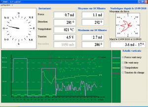
Software for recording and graphic representation of wind data and atmospheric pressure for LCJ Capteurs wind vane-wind speed indicators. For Windows.
... The systems are designed to measure all weather conditions during helicopter landing and take-off operations in order to improve both flight and passenger safety. The system can interface with multiple weather ...
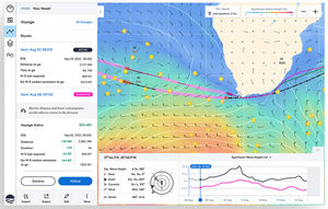
... that delivers the most efficient and least weather-restricted speed and waypoint recommendations to your fleet. The platform is powered by our global network of ocean sensors, which produces the best marine weather forecasts ...
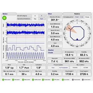
Weather software is a program allowing an onboard computer to receive, compile and analyze meteorological data to facilitate the mariner's decisions.
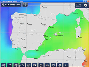
ApplicationsThese programs are used on both recreational and commercial craft. Each offers a different range of functions, which may include display of WeatherFax, Navtex, RTTY or GRIB bulletins, data from on-board sensors, satellite images or even storm detection within a given radius.
Some supply Pilot Charts, which offer weather and sea data gathered by the U.S. Weather Service since 1850 from locations around the world. This includes wind, current and other sea and weather statistics for different periods of the year. Other programs suggest optimal routes as a function of vessel parameters and GRIB wind speed and direction forecasts.
Certain software only works if the boat's computer is connected to sensors. GRIB files are accessible via an Internet connection, for example via GSM (cellphone) in coastal areas or direct satellite link (e.g., standard C-band) offshore.
How to chooseChoice will depend on compatibility between the vessel's computer operating system and the software.
the best suppliers