
{{product.productLabel}} {{product.model}}
{{#if product.featureValues}}{{product.productPrice.formattedPrice}} {{#if product.productPrice.priceType === "PRICE_RANGE" }} - {{product.productPrice.formattedPriceMax}} {{/if}}
{{#each product.specData:i}}
{{name}}: {{value}}
{{#i!=(product.specData.length-1)}}
{{/end}}
{{/each}}
{{{product.idpText}}}

Navionics+ provides complete inshore to offshore marine content, plus rivers, bays, and more than 39,550 lakes around the world. ______________________________________________________________________________________________________________________________________________________________ > ...
Navionics
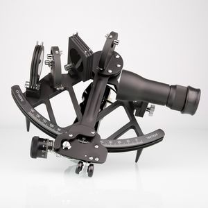
Black 4 x 40mm telescope Full-view or traditional split-view mirror Including wooden case With quality certificate Description The frame of the CPSailing is made of seawater-resistant aluminum. It can be equipped with a full-view ...
Cassens & Plath GmbH
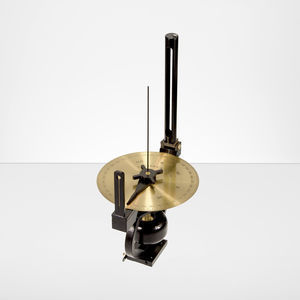
The Pelorus is used for relative bearings and compass bearings. The rotatable brass degree scale has a diameter of 160 mm and a full-circle degree marking. Same can be locked to adjust the compass course. A hinged sight vane on the ...
Cassens & Plath GmbH
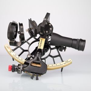
Black or white frame 4 x 40mm telescope Specialist for sun observations Full-view mirror Double prism (Schüler) Polarized shade lenses Combined dip and index error adjustment Engraving optionally Including wooden case or rough ...
Cassens & Plath GmbH

Your navigation area, usage and habits are some of the many criteria to take into account before making the right choice for your nautical chart. Raster or Vector, let’s get into their differences. Vector charts are extremely accurate ...
MaxSea International

C-MAP 4D MAX+ is the latest evolution of electronic charting technology, combining award-winning vector chart data with exclusive Dynamic Raster Charts and the ability to view charts in 2D or amazing 3D presentation with high-resolution ...
C-MAP
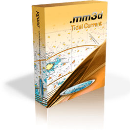
EUROPEAN High Resolution TIDAL CURRENTS Precursors in marine chart production and additional marine data such as the Tidal currents Atlas, MapMedia also offers European high resolution tidal currents. Data produced by national hydrographic ...
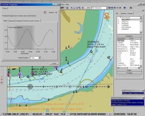
Navmaster ECS is an electronic chart system closely based on the type-approved Navmaster ECDIS software. It provides navigators with the full range of ECDIS navigation tools without the expense of type-approved components. It is simple ...
PC Maritime
Please specify:
Help us improve:
remaining