
{{product.productLabel}} {{product.model}}
{{#if product.featureValues}}{{product.productPrice.formattedPrice}} {{#if product.productPrice.priceType === "PRICE_RANGE" }} - {{product.productPrice.formattedPriceMax}} {{/if}}
{{#each product.specData:i}}
{{name}}: {{value}}
{{#i!=(product.specData.length-1)}}
{{/end}}
{{/each}}
{{{product.idpText}}}
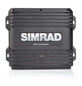
NSO evo2 is perfect for creating truly customised multi-display systems aboard powerboats 10 metres (33 feet) and larger. This ‘black box’ marine processor can drive two independent multifunction displays, with support for both touchscreen and non-touch ...
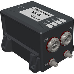
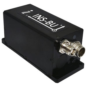
The Hemisphere VS-i8 is a high accuracy, high precision, Inertial Navigation System (INS) product. Featuring Honeywell® proprietary sensor fusion technology, the VS-i8 leverages a powerful multi-frequency, multi-constellation, RTK-ready navigation and ...
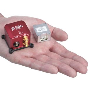
... External GNSS for Navigation Ellipse-E is a versatile miniature Inertial Navigation Sensor that connects to external GNSS receiver to provide navigation data, and other sensors such as DVL or odometer. It is best suited in case of specific GNSS ...
SBG systems
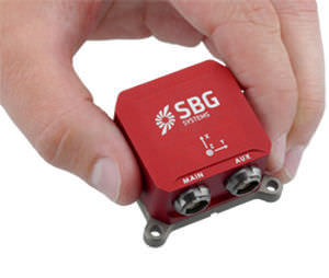
... Single Antenna RTK GNSS Ellipse-N is a compact and high-performance RTK Inertial Navigation System (INS) with an integrated Dual band, Quad Constellations GNSS receiver. It provides roll, pitch, heading, and heave, as well as a centimetric GNSS position. Ellipse-N ...
SBG systems
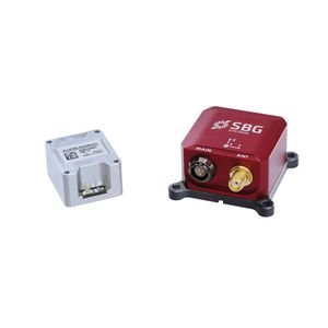
... Dual Antenna RTK INS Ellipse-D is the smallest Inertial Navigation System integrating a Dual-antenna, multi-band GNSS receiver, capable of delivering precise heading as well as centimeter level position accuracy in the most challenging GNSS conditions. It ...
SBG systems
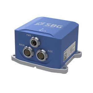
... Ekinox-E additionally accepts aiding data from external GNSS receiver to provide navigation. The Ekinox-E has been designed to connect up to 4 external aiding systems, including DVL or DMI. This highly versatile inertial navigation system provides ...
SBG systems
... Motion & Heave Apogee-A is a highly accurate Motion Reference Unit (MRU). The Apogee-A is based on the robust and cost-effective MEMS technology and provides precise orientation and heave data. 0.008° Roll and Pitch over 360° 0.015° Heading ...
SBG systems
... FOG-based IMU Horizon IMU brings Navsight to the most demanding environments such as highly dense areas, low dynamic surveys, and applications where only a single antenna can be used. Horizon IMU is based on a closed-loop FOG technology which enables ...
SBG systems
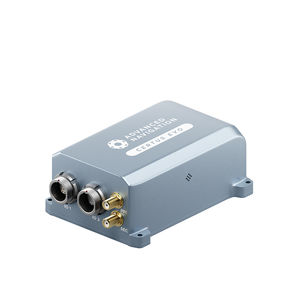
Certus combines temperature calibrated accelerometers, gyroscopes, magnetometers, and a pressure sensor with a dual antenna GNSS receiver. These are coupled in an AI-based fusion algorithm to deliver accurate and reliable navigation data. It features ...
Advanced Navigation
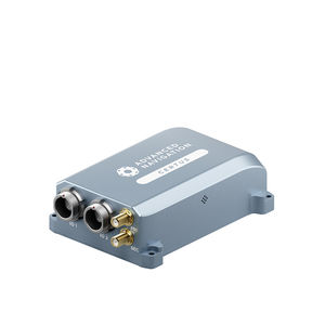
Certus Evo is an AI-based MEMS GNSS-aided INS that provides extremely accurate position, velocity, acceleration, and orientation under the most demanding conditions. It offers FOG-like performance combined with the reliability and affordability of MEMS ...
Advanced Navigation
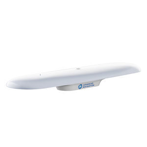
GNSS Compass is an all-in-one GNSS/INS navigation and heading solution.It provides accurate dual-antenna GPS-based heading that is not subject to magnetic interference and can maintain accurate heading during GNSS outages of up to 20 minutes. It features ...
Advanced Navigation
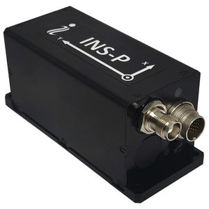
... INS-P Single Antenna Professional Single GNSS Antenna - - - - - - - - - - Heading Accuracy: 0.4° static / 0.1° dynamic Position Accuracy: 1cm (RTK), 2.5cm (PPP), 60cm (SBAS) Pitch & Roll Accuracy: 0.03° dynamic, 0.05° static GNSS Constellations: ...
Inertial Labs, Inc.
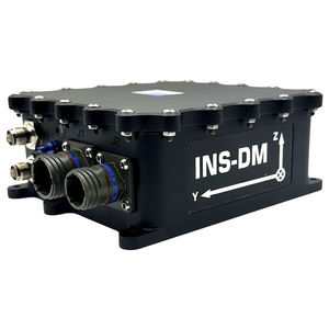
... The Inertial Labs GPS-Aided Inertial Navigation System (INS-DM) is the latest version of Inertial Navigation System, developed by Inertial Labs. The INS-DM is the result of over 20 years of our experience in developing and supplying INS solutions to ...
Inertial Labs, Inc.
... Input signals • Marine application: DVL (Doppler Velocity Log) • Land application: Odometer, Wheel sensor, Encoder, DMI • Aerial application: Wind sensor, Air Speed Sensor, Doppler shift from locator (for long-term GPS denied) • All: External ...
Inertial Labs, Inc.
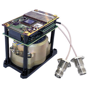
... • Fully Integrated Honeywell HG4930 IMU • Commercial ECCN 7A994 (No License Required) Export Status • Precision Real time (RTK) & Post Processing (PPK) • High Precision NovAtel Dual Antenna GNSS Receiver • Honeywell HG4930 Tactical-grade IMU • Position ...
Inertial Labs, Inc.
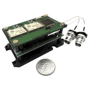
... Low Cost Single Antenna GPS-Aided Inertial Navigation Systems Input signals • Marine application: DVL (Doppler Velocity Log) • Land application: Odometer, Wheel sensor, Encoder, DMI • Aerial application: Wind sensor, Air Speed Sensor, Doppler ...
Inertial Labs, Inc.
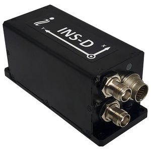
... INS-D Dual Antenna Dual GNSS Antenna Inertial Navigation System - - - - - - - - - - Heading Accuracy: 0.8° (2m baseline) / 0.15° (1m baseline). Position Accuracy: 1cm (RTK), 2.5cm (PPP), 60cm (SBAS). Pitch & Roll Accuracy: 0.03° dynamic, ...
Inertial Labs, Inc.
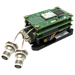
... INS-D-OEM Dual Antenna Dual GNSS Antenna OEM INS - - - - - - - - - - Heading Accuracy: 0.08° (2m baseline) / 0.03° (PPK). Position Accuracy: 0.5cm (PPK), 1cm (RTK), 60cm (SBAS). Pitch & Roll Accuracy: 0.05° static / 0.03° dynamic / 0.006° ...
Inertial Labs, Inc.