
{{product.productLabel}} {{product.model}}
{{#if product.featureValues}}{{product.productPrice.formattedPrice}} {{#if product.productPrice.priceType === "PRICE_RANGE" }} - {{product.productPrice.formattedPriceMax}} {{/if}}
{{#each product.specData:i}}
{{name}}: {{value}}
{{#i!=(product.specData.length-1)}}
{{/end}}
{{/each}}
{{{product.idpText}}}

... discounted price. > Charts & Updates - Nautical Chart - comprehensive charts derived from multiple official, government and private sources, displayed in a familiar look and feel - ...
Navionics

... discounted price. > Charts & Updates - Nautical Chart - comprehensive charts derived from multiple official, government and private sources, displayed in a familiar look and feel - ...
Navionics

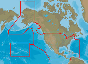
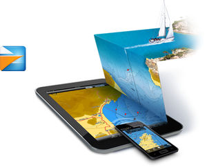
... Detailed Nautical Charts Wherever You Go Nautical charts for cruising, fishing, sailing, diving and all the other activities on the water. The same detailed marine ...
Navionics

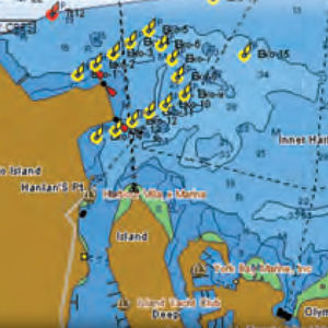
... Vector Charts allow you to customize your chart display. Raster charts Main advantages Similar appearance to marine paper charts. Reliability of true color copy ...
MaxSea International

... paper charts. Vector charts become very inaccurate when over zoomed. Where do electronic charts originate? Marine Vector Charts utilize a vector database to build ...
MaxSea International

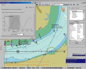
... your marine charts. The most accurate tidal currents data at any time 4 areas are available: English Channel - Hamburg France UK & English Channel Iberia Overlay your high resolution tidal current data ...
MaxSea International

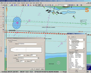
... comprehensive coverage throughout European and American coasts. Overlay your high resolution satellite photos directly on your marine chart High resolution satellite photos enable to know the coast in details and ...
MaxSea International

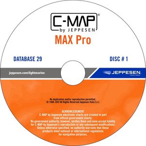
... the latest evolution of electronic charting technology, combining award-winning vector chart data with exclusive Dynamic Raster Charts and the ability to view charts in 2D or amazing 3D presentation with ...
C-MAP
... Essentials gives Raymarine customers what they need to begin their journey with trusted C-MAP cartography. It combines the coastal chart data required to navigate safely and confidently with large coverage areas to meet the needs of sailors, ...
C-MAP
... C-MAP MAX electronic charts have been a worldwide standard for years, providing cruisers, sailors and fishermen with the accurate, up-to-date chart data they need to enjoy each day on the water. Still a leading choice ...
C-MAP
... New C-MAP MAX-N cartography gives Lowrance, Simrad and B&G customers access to accurate, up-to-date C-MAP chart data trusted by navigators around the globe. C-MAP MAX-N opens up a new world of performance for cruisers, sailors and fishermen, ...
C-MAP

... G navigation systems. Whether you’re an avid saltwater angler, sailing enthusiast or long-range cruiser, these powerful charts will enhance every moment you spend on the water. With huge coverage areas, up-to-date data and state-of-the-art ...
C-MAP
... Coast Guard Notice to Mariner (NTM) changes and other important chart data updates. Rich chart detail and available data to aid in safe navigation Easy on-screen queries of chart objects for ...
C-MAP
... Imagine a free app for your mobile device that brings your C-MAP charts to life. Whether your passion is sailing, fishing or cruising, the Plan2Nav app makes your navigating experience even more fun! ...
C-MAP
... Updating. With Quick Sync, you’ll get unlimited updates on demand. In addition, you can rent charts for four months so you’ll always have the most accurate charts ad updated information. ...
C-MAP
... Navmaster ECS is an electronic chart system closely based on the type-approved Navmaster ECDIS software. It provides navigators with the full range of ECDIS navigation tools without the expense of type-approved components. It is simple ...
PC Maritime
... Navmaster Pilot is a portable, simple-to-use electronic chart system based on Type Approved Navmaster ECDIS software and with additional features to assist pilots. Navmaster Pilot provides software and wireless interfacing so that a ...
PC Maritime
the best suppliers