
{{product.productLabel}} {{product.model}}
{{#if product.featureValues}}{{product.productPrice.formattedPrice}} {{#if product.productPrice.priceType === "PRICE_RANGE" }} - {{product.productPrice.formattedPriceMax}} {{/if}}
{{#each product.specData:i}}
{{name}}: {{value}}
{{#i!=(product.specData.length-1)}}
{{/end}}
{{/each}}
{{{product.idpText}}}
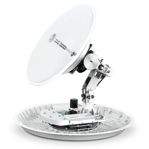
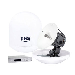
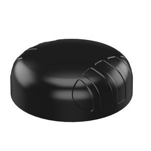
Frequency range: 10.7, 14.5 GHz
Gain: 40.7, 38.9 dB
Diameter: 85 cm
... The World’s First Future Proof Ku- to Ka-band Convertible Sub-1m VSAT Intellian v85NX is a Ku- to Ka-band convertible maritime VSAT antenna system with a 85cm diameter reflector. The compact 85cm antenna’s smaller footprint allows installation on smaller ...
Intellian Technologies
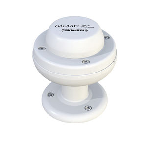
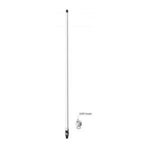
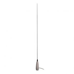
Using the latest satellite radio technology, this SiriusXM®-approved accessory meets or exceeds the most recent specifications set forth by SiriusXM®. This antenna is compatible with all radios and docks that work on the SiriusXM® network with a push-on ...
Shakespeare
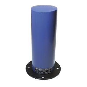
Frequency range: 2.4 GHz
Diameter: 250 mm
Height: 300 mm
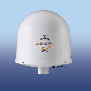
... weBBoat® Plus 5G is the new WORLDWIDE* Dual SIM 5G/Wi-Fi All-in-One Plug & Play Coastal internet system to get internet on board and a secure Wi-Fi hotspot inside and outside the boat thanks to the in-built 5G and Wi-Fi antennas for fast connection up ...
Glomex

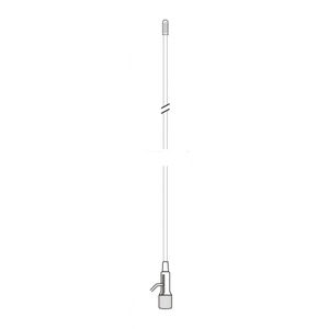
Operating temperature: -55 °C - 70 °C
Diameter: 29 mm
Height: 1,360 mm
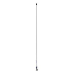
Our antennas are made of fiberglass and/or stainless steel for high-end applications where maximum range and durability are important for example usage on oceans and large lakes. We recommend fiberglass tube antennas, which are coated with smooth polyurethane ...
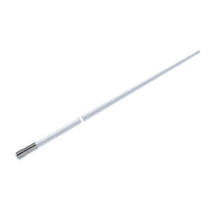
Our innovative VHF antennas come in two interchangeable parts for installation ease and flexibility. The cable is hardwired to the mount, so the antenna can be can be removed or replaced whenever necessary without pulling or cutting the cable. Ordinary ...
Lowrance
Frequency range: 2,400 MHz - 5,800 MHz
Gain: 16 dB
Height: 89 mm
... Description
- Directional antenna for point-to-point wireless links in the 2.4 GHz and 5.8 GHz bands
Key features
- Available for 2.4 GHz and 5.8 GHz
- Gain: 16 dBi
- Ingress protection: IP66
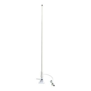
Frequency range: 700 MHz - 2,100 MHz
Gain: 2.5 dB - 5 dB
Length: 580 mm
... For over 60 years GME has designed and manufactured an extensive range of high quality accessories to suit a wide variety of applications. From 4WDing to Boating and Fishing, GME has a genuine accessory to meet every need. Utilising the proven, rugged, ...
GME electrophones

Operating temperature: -30 °C - 70 °C
... Heading updates 1 to 20 Hz BAUD Rate selectable: 4800, 9600, 19200, 38400,115200 Pre-programmed default settings for Heading, Rate of Turn, Course over Ground, Lat/Long position, Time & Date CE certified for EMI and RFI immunity IMO compliant, Wheelmark ...
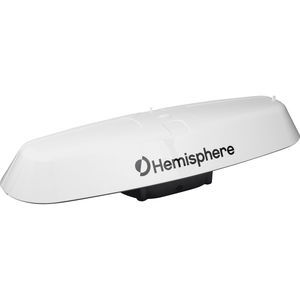
Frequency range: 283.5 kHz - 325 kHz
Electrical power: 3.3, 3.6 W
Operating temperature: -40 °C - 70 °C
The Vector™ V123/133 is Hemisphere GNSS’ all-in-one single-frequency, multi-GNSS smart antenna which supports submeter-level position and up to 0.4° (RMS) heading accuracy. This rugged design is sealed for the harshest environments and is a great solution ...
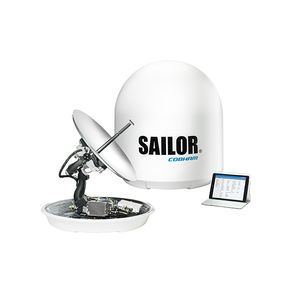
... Your future-proof mid-size VSAT antenna for any Ku-band service globally. Unlock the power to optimize delivery and performance of broadband at sea for business applications, vessel operations and crew welfare with SAILOR 600 XTR Ku. The sophisticated, ...
Cobham
... The SuperTrack A-Series service package enables maritime customers to not only benefit from an ”always on” internet connection and VolP services but also to cut down on the high cost equipment and services. The SuperTrack A-Series supports various applications ...
Frequency range: 146 MHz - 440 MHz
Gain: 2.15, 3 dB
Operating temperature: -55 °C - 60 °C
UHF/VHF2 is an omnidirectional dipole antenna covering VHF marine band and a UHF subband. Radiating elements are made of brass. The antenna is manufactured using crimping technology, giving the antenna a 4-5 times stronger build-up. The swivel nut N239F ...
AC ANTENNAS A/S
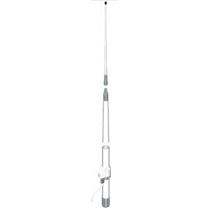
Frequency range: 156 MHz - 162 MHz
Gain: 3 dB
Electrical power: 50 W
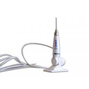
... QuickFit is the brand-new line of ready-to-install marine antennas by Scout, that do not require the installation of RF connectors, easy to remove and totally waterproof thanks to the Scout original foam injection technology. QuickFit antennas are ...
Scout S.r.l.
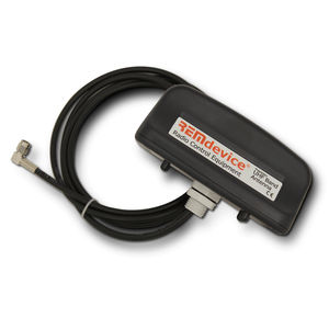
... UHF Rugged and reliable, waterproof, suitable for all applications. Comes with cable in standard 1.5m length and SMA or SMB connector (depending on the model). Working frequencies: 418 MHz, 433-434 MHz, 870 MHz, 915 MHz. TECHNICAL SPECIFICATIONS Working ...
Rem device
Frequency range: 617 MHz - 7,200 MHz
Gain: 6, 7.5 dB
Electrical power: 10 W
Poynting’s new PUCK range offers a small profile antenna for use in the IoT/M2M, Smart Meter, Smart Utilities, Transportation, Marine and the Agricultural/Farming markets. The PUCK-7 consists of a 4-in-1 antenna system within a single housing, featuring ...
Poynting Antennas
Frequency range: 380 MHz - 3,000 MHz
... Wideband LTE and TETRA antenna HIGHLIGHTS • Extended version of proven 4G LTE antenna proTAC 5311. It seamlessly covers the range 380MHz – 3GHz without compromises in performance • Easy to use 4-bolt flange mount • Does not require ground plane ...
Promarine Ltd
... ■ High Performance with durable structure ■ 3.8 ft fiberglass antenna ■ 3 dB gain ■ 10 meters RG-58 coaxial cable with PL259 connector ...
Frequency range: 156 MHz - 163 MHz
Gain: 3 dB
Electrical power: 200 W
... Jetfon NVF-3 is a VHF marine antenna with an articulated support with plastic cover. FEATURES Bandwidth: 7 MHz Rod length: 112 cm Fiberglass Holder: articulated for plastic cover. 4 m RG-58C/U MIL-C-17/F Connector: PL-259QC Jetfon MV-158 ...
Pihernz
Frequency range: 156 MHz - 162 MHz
Gain: 3 dB
Electrical power: 50 W
SCOUT has designed the KS-23A antenna specifically for small boats and RIBs, that require a light antenna, flexible, resistant and with high performance. The KS-23A brings all these features together in only 90 cm length. The stainless steel whip guarantees ...
Nasa Marine
... Marine antenna HF-SSB 1,6-30 MHz - 5,60 MT (18 ft) - Mounting on base and bracket (not included) lateral connection (side exit) with chromed coupling. The fine finish makes it suitable for prestigious boats Transmission with ATU - Reception with ...
Banten antenne radio
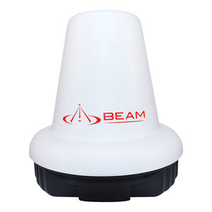
Frequency range: 1,525 MHz - 1,675 MHz
Operating temperature: -40 °C - 70 °C
Height: 207 mm
... The Inmarsat Mast Active Antenna ISD710 is a marine grade antenna for the Inmarsat GSPS service and whilst designed predominantly for maritime based applications, it can be also used in fixed site or mobile applications. Inmarsat Beam Mast/Pole Marine ...
Beam Communication
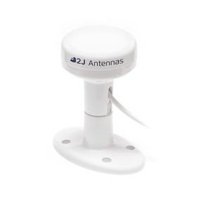
Frequency range: 1,575.42 MHz - 1,627 MHz
Gain: 5.1, 5.7 dB
Operating temperature: -40 °C - 85 °C
... Passive GNSS-IRIDIUM Antenna Iridium Certified Antenna Compact Marine antenna Ground Plane Independent 5.7 dBi GNSS Peak Gain High Performance High Efficiency Single Feed Technology Configurable Mount options Adhesive Mounting sticker ...
2J Antennas s.r.o.
Type5/8Power250WGain (dB)6dBd (8,15dBi)Impedance50 ohmMaterialFiberColourWhiteR.O.E - S.W.R - T.O.S1,4:1Type mountingMast 25-60 mmConnector typeCable 5,5 methers RG58Electrical shunt shield protectionYesPolarizationVerticalWind load150 KmTemperaturefrom ...
ANTENAS TAGRA

... Recommended for boats from 13 to 18 meters. The satellite antenna MST55IP is enclosed in a radome of barely 58 cm and allows exploiting the advanced satellite services such as internet and telephony. It is currently the smallest antenna in the IP ...
Navisystem Marine Electronics
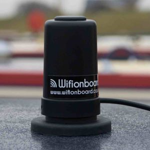
... This antenna is ideal for mounting on the roof of your canal boat, it has a rare earth magnet that keeps it secure when in use and can be packed away when the boat is not in use. The unit works on all mobile networks whether they are 2,3 or 4G Available ...
Wifionboard